
|
Positively Pottering
East Midlands |
1051 of 1170
Wed 8th Nov 2023 1:47am
As a youngster growing up in Canley I would often see monobloc four wheel oil tank wagons going into a siding near a railway cottage at Yarmouth Green north of Tile Hill Station.
I assume this siding was an oil storage depot with vehicular access via Torrington Avenue?
Does anyone have any further info on this please?
Question |
| Public Transport and Travel - Railways around Coventry | |
|
Mick Strong
Coventry |
1052 of 1170
Wed 8th Nov 2023 12:04pm
Hi PP
Growing up in Canley during the 50's & 60's, I used the path that went under the railway line opposite Yarmouth Green to get to Woodlands. Dont ever remember an Oil Depot or a loop in the lines though.
There is still a building next to the railway line that is now a nursery.
I now live in Duggins Lane and there is a loop at the end of my garden, it is used to hold the goods trains while the express and local trains pass. It was used more recently to store around 5000 sleepers for the HS2 build.
Mick Strong
|
| Public Transport and Travel - Railways around Coventry | |
|
NeilsYard
Coventry |
1053 of 1170
Wed 8th Nov 2023 12:11pm
I can see something called Park Wood Cottages in that area (more where Bradney Green is today) on a 1930's map but no specific siding?
You can possibly see what remained of them when the then 'new' estate went up here from BFA - from 1949 - though again no siding.
There are some great Tile Hill Station Pics though here on the brilliant Warwickshire Railways Website.
|
| Public Transport and Travel - Railways around Coventry | |
|
PeterB
Mount Nod |
1054 of 1170
Fri 10th Nov 2023 7:50pm
Tile Hill station goods yard was to the south east of the level crossing/bridge and is now occupied by the car park. According to An Historic Survey of LMS Stations (Vol 2) there was a 250 foot long siding along the south side of the line towards Canley.
An aerial photo from the second world war from Historic England shows the path under the railway, but doesn't show the additional siding at the time it is most likely to have existed. Unfortunately there is no photo of the station itself.
The "nursery cottage" is absent from the National Library of Scotland1840-1880 OS map, but is present on the 1885-1900 map so probably dates from the mid-late 19th Century. This is some distance from the goods yard and the surrounding area was fields so I presume the house was for a track worker.
The loop on the Birmingham side of the station was added in the 1960's as part of the electrification works. It was signalled for passenger and goods trains and was used to loop a local while a late running InterCity overtook it. It fell out of use as freight trains became too long and regulating policy changed to further delay late trains more rather than make an on-time train late.
|
| Public Transport and Travel - Railways around Coventry | |
|
matchle55
Coventry |
1055 of 1170
Sun 12th Nov 2023 4:55pm
On 8th Nov 2023 12:04pm, Mick Strong said:
Hi PP
Growing up in Canley during the 50's & 60's, I used the path that went under the railway line opposite Yarmouth Green to get to Woodlands. Dont ever remember an Oil Depot or a loop in the lines though.
There is still a building next to the railway line that is now a nursery.
I now live in Duggins Lane and there is a loop at the end of my garden, it is used to hold the goods trains while the express and local trains pass. It was used more recently to store around 5000 sleepers for the HS2 build.
Hi Mick, at that time I lived in Templar ave, the oil depot was, I think Esso (my brother will know), this area is now Binns close  |
| Public Transport and Travel - Railways around Coventry | |
|
Langtonian
Coventry |
1056 of 1170
Sun 12th Nov 2023 6:29pm
The 1968 6 inch OS map clearly shows the depot, with the sidings and storage tanks.
|
| Public Transport and Travel - Railways around Coventry | |
|
PeterB
Mount Nod |
1057 of 1170
Wed 20th Dec 2023 4:16pm
The Office of Rail and Road has published the 2022-23 station usage estimates. These cover the period April 2022 to March 2023. This is the first full year without lockdowns, but does include the rail strikes which started in June 2022. I estimate there were 22 strike days in this period. Locally there was no service on ASLEF strike days and a limited service on RMT strike days.
Nationally passenger journeys were up 40% on 2021-22, but a lot of this is due to the Elizabeth Line.
The % change from 2021-22 is in brackets. New this year is the most popular destination from each station.
Bedworth 54,536 (+41%) Coventry
Berkswell 222,208 (+37%) Birmingham New Street
Bermuda Park 21,942 (-15%) Coventry
Birmingham International 4,185,090 (+74%) Birmingham New Street
Birmingham New Street 30,726,280 (+35%) London Euston
Canley 363,796 (+41%) Birmingham New Street
Coventry 5,976,658 (+29%) Birmingham New Street
Coventry Arena 107,660 (+58%) Coventry
Hampton-in-Arden 131,182 (+40%) Birmingham New Street
Kenilworth 139,132 (+76%) Coventry
Leamington Spa 2,090,736 (+26%) London Marylebone
London Euston 31,318,488 (+36%) Manchester Piccadilly
Nuneaton 960,480 (+14%) Birmingham New Street
Rugby 1,913,342 (+12%) London Euston
Tile Hill 428,386 (+31%) Birmingham New Street
Wolverhampton 4,445,864 (+29%) Birmingham New Street
Coventry is still 27% below its peak in 2018/9, but is back at 2013/4 levels which were considered good at the time. The train service has mostly returned to pre-Covid levels with the main changes being the Avanti service to London Euston has gone from a 20 minute "one stop" service to a 30 minute "non-stop" service and an additional hourly "three stop" service. .
A separate spreadsheet gives a beak down of station to station journeys. The most popular destinations from Coventry are:
Birmingham New Street 36%
London Euston 17%
Rugby 6%
Birmingham International 5%
Leamington Spa 4%
Milton Keys Central 3%
Wolverhampton 2%
Banbury 2%
Northampton 2%
Journeys were made to 1856 stations (72% of the total).
|
| Public Transport and Travel - Railways around Coventry | |
|
PhiliPamInCoventry
Holbrooks Thread starter
|
1058 of 1170
Tue 4th Jun 2024 5:35pm
Hello,
My volunteering duty has taken me on some train journeys recently.
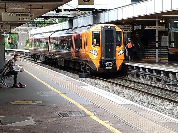 These are new two coach units being used on the Nuneaton to Leamington line. Here's a unit having arrived in Coventry from Leamington, waiting to depart to Nuneaton.
Very comfy.
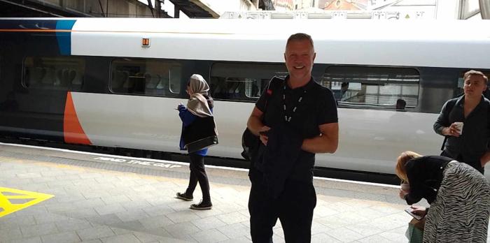
From the window of my London bound train, I saw this brand new Hitachi train having arrived in Coventry. Six units only entered service on Sunday, with five more due later.
These are new two coach units being used on the Nuneaton to Leamington line. Here's a unit having arrived in Coventry from Leamington, waiting to depart to Nuneaton.
Very comfy.
From the window of my London bound train, I saw this brand new Hitachi train having arrived in Coventry. Six units only entered service on Sunday, with five more due later.
 I only use the trains if I'm privatizing on my own risk, because planing ahead for charities is frought with unreliability associated with the industrial action.
 |
| Public Transport and Travel - Railways around Coventry | |
|
PhiliPamInCoventry
Holbrooks Thread starter
|
1059 of 1170
Tue 4th Jun 2024 7:36pm
Hello,
Volunteering, I avoid relying on Google mapping for any accompanying roll, without physically seeing it in reality. So when I was accompanying a client to Birmingham Q/E, recently, I decided to come back to Coventry from the current Edgbaston tram terminal.
The Edgbaston tram terminal, called Edgbaston Village, is where the funding ran out. That's the best way that I can describe it. I couldn't use it with a client unless they were very athletic.
The tram section from the New Street station tram stop, called Grand Central, to Edgbaston is run on tram battery power, so avoiding the use of overhead line installations through the visiting district.
Digression into Birmingham on our website, is appropriate, because like Rugby, Birmingham hospital plays host to hundreds of Coventrians. Serious burns is very high on referrals for Coventry folk, whereas Rugby plays host to many mobility rehabilitation patients.
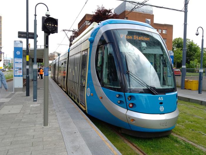 Edgbaston tram terminal.
I've not included Rugby in the railway topic, because Rugby railway station is very inconveniently located for the town & certainly the hospital.
Using the Birmingham trams is easy and accessible using the West Midlands issued bus pass. The seating isn't luxurious or particularly comfy for long journeys. The basic route is Birmingham to Wolverhampton, so travelling from Coventry to Wolverhampton, I would always recommend the train, providing they are running. If the trains are not running, the trams are packed like sardines anyway.
Edgbaston tram terminal.
I've not included Rugby in the railway topic, because Rugby railway station is very inconveniently located for the town & certainly the hospital.
Using the Birmingham trams is easy and accessible using the West Midlands issued bus pass. The seating isn't luxurious or particularly comfy for long journeys. The basic route is Birmingham to Wolverhampton, so travelling from Coventry to Wolverhampton, I would always recommend the train, providing they are running. If the trains are not running, the trams are packed like sardines anyway. |
| Public Transport and Travel - Railways around Coventry | |
|
PhiliPamInCoventry
Holbrooks Thread starter
|
1060 of 1170
Fri 7th Jun 2024 7:31pm
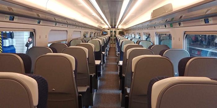
Hello.
A brand new train.
 & The driver posing for me.
 |
| Public Transport and Travel - Railways around Coventry | |
|
Rob Orland
Historic Coventry |
1061 of 1170
Sun 9th Jun 2024 10:39am
Hey, I reckon that's me ol' mate Dave Brooks! Last time I bumped into him he informed me that it was he who had just dropped us off from Birmingham New Street - and until that moment I didn't even realise he'd become a train driver!
 |
| Public Transport and Travel - Railways around Coventry | |
|
PhiliPamInCoventry
Holbrooks Thread starter
|
1062 of 1170
Sun 9th Jun 2024 1:37pm
Hi Rob,
He was certainly proud of his new train & why not.
For now, they are restricted to 110, mph on the West Coast mainline. They are a Hitachi hybrid. Each vehicle is equipped with its own diesel engine for negotiating none electrified routes, but the "Pants" are up for the overhead wires.
They are replacing the much older Bombardier units, which have no facility to use electric.
|
| Public Transport and Travel - Railways around Coventry | |
|
Slim
Another Coventry kid |
1063 of 1170
Mon 10th Jun 2024 11:31am
I think the railways are brilliant. Especially when, like Saturday just past, they are on time and not cancelled. I use rail a lot. Much better than using my car. Less tiring. No unnecessary temporary traffic lights, road closures for silly things like some public event, no aggressive drivers up your backside, no ditherers in front - why are ditherers always so close to my front bumper?! LOL - no parking problems when you arrive, no rip-off-England parking fees...
Back to Saturday just gone. I board the 0708 form KNW, then the 0739 from LMS to RDG. My appointment was 0930 in Reading. I'm in Wetherspoons at 0850 having a coffee, when the agent rings and says they've had to cancel the appointment, can I do it later in the week? GRRR. So I says can you do it later today? Good job I had all day free. They re-scheduled it for 1530, which was ok.
So I had 6 hours to kill. Right, don't waste time Slim, go to my London office (the Coach and Horses) for a couple of Guinesses (£7 per pint) then some grub. I got a return ticket form RDG to PAD for about £12. There are 51 trains on a Saturday form RDG to the Smoke terminals, a lot more om weekdays. I board a GWR on the Crossrail line (they call it the Elizabeth line now), non-stop, it fair batted along, and I'm in central London 22 minutes later.
|
| Public Transport and Travel - Railways around Coventry | |
|
PhiliPamInCoventry
Holbrooks Thread starter
|
1064 of 1170
Tue 18th Jun 2024 6:53am
Hello,
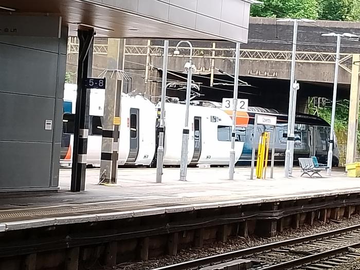
Work is proceeding in the area of the old Coventry goods yard, upgrading the multiple unit stabling sidings for both diesel & electric. This may include cleaners & basic service.
I'm hearing gossip that most railways companies are trying to do away with first class, possibly replacing first class with reservation sections, but requiring a surcharge to the normal travel price.
That is only gossip, but several franchises have already dropped first class.
|
| Public Transport and Travel - Railways around Coventry | |
|
PhiliPamInCoventry
Holbrooks Thread starter
|
1065 of 1170
Sat 22nd Jun 2024 1:23pm
Hello,
I mentioned out & about in another conversation but anyway, I've been travelling to the extremes of my bus pass limits on our local rail network, but having the odd bit of fun buying bolt on online tickets.
I was very comfy sat on a train from New St, to Wolverhampton, when I decided to carry on to Shrewsbury, just for the ride. With my railcard, just over £8 return.
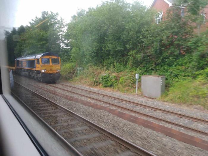 Whether I'm playing trains at home, or looking out of the carriage window at this kind of scene, I'm just the little boy from seventy years ago.
 |
| Public Transport and Travel - Railways around Coventry | |

Website & counter by Rob Orland © 2025
Load time: 607ms
