
|
Helen F
Warrington |
226 of 514
Sun 24th Apr 2016 8:36am
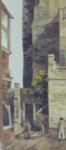
This is the building on the corner of Conduit Yard. It is the only image contemporary with the gate that shows it. All the others show it being open on the left of the gate, which makes me wonder now if the area was demolished prior to the gate's demise. Dr Troughton also drew the area but I think he was interpreting another picture, possible even this one.
|
| Streets and Roads - Spon Street | |
|
Heathite
Coventry |
227 of 514
Mon 25th Apr 2016 8:07am
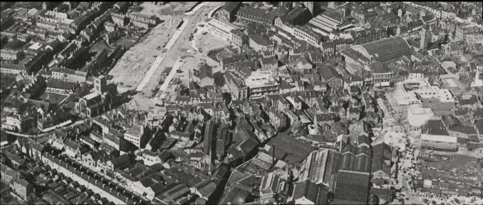 Hi all, I don't know if this link will work, it may show the area being discussed, is it post war? apologies if that's an obvious question.
View Map online
Hi all, I don't know if this link will work, it may show the area being discussed, is it post war? apologies if that's an obvious question.
View Map online
|
| Streets and Roads - Spon Street | |
|
Helen F
Warrington |
228 of 514
Mon 25th Apr 2016 9:30am
Yes Heathite, the area on the left, opposite the church is the bit I'm wondering about. The photo shows the building of Corporation Street, in 1931 which looks a lot like bomb damage  The buildings opposite the church are relatively new by this point. The buildings opposite the church are relatively new by this point. |
| Streets and Roads - Spon Street | |
|
Heathite
Coventry |
229 of 514
Mon 25th Apr 2016 9:33am
Hi, I took another look at the link and the photo is from 1941, they are German reconnaisance images I think. |
| Streets and Roads - Spon Street | |
|
Helen F
Warrington |
230 of 514
Mon 25th Apr 2016 9:46am
1941 was possibly when they acquired it. It must be an earlier photo because by 1937 there was a big white building on Well Street that's missing from the linked photo. Alternatively Britain from Above have it wrong. |
| Streets and Roads - Spon Street | |
|
Annewiggy
Tamworth |
231 of 514
Mon 25th Apr 2016 10:31am
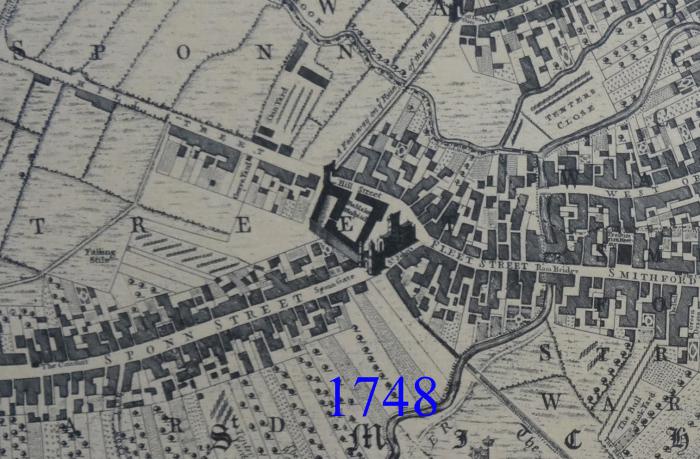
You have probably looked at this Helen but this is an interpretation of a c1750 map , move it around to find Fleet Street. This map was in the collection of Coventry stuff so I don't know who compiled it. It just says "Coventry circa 1750, and with major features in late medieval times.
1750 map
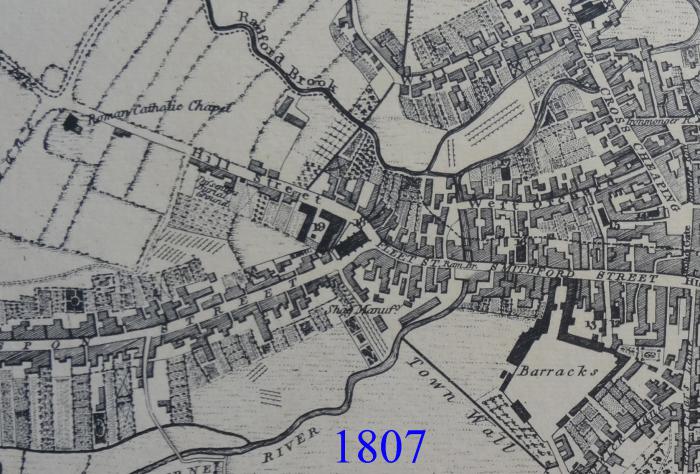
Just found a reference in The Coventry Standard 1856 that says Spon Gate was taken down in 1771, the same year that the cross was wholly taken down. |
| Streets and Roads - Spon Street | |
|
Helen F
Warrington |
232 of 514
Mon 25th Apr 2016 11:01am
Thanks Anne, that's the map that tells me the corner was shaved off. Obviously the map maker didn't have any more information than I've seen so far. Where able, the blocks have been divided up using later maps but that area was modified just too early. I'm not going to get a picture of that area I don't think, but I might be able to work out how many front doors there were or if there were businesses. It's a very long shot and I think I might have to bite the bullet and start reading records. |
| Streets and Roads - Spon Street | |
|
NeilsYard
Coventry |
233 of 514
Tue 26th Apr 2016 2:38pm
I was in Watch Close on Sunday a.m. as my youngest was at a 'Studio 21' (!) Laserquest party. I had never really noticed the rear of these buldings on Spon Street visible from Watch Close. Anyone know anything about their former usage?
 |
| Streets and Roads - Spon Street | |
|
Heathite
Coventry |
234 of 514
Tue 26th Apr 2016 4:12pm
On 25th Apr 2016 11:01am, Helen F said:
Thanks Anne, that's the map.
Three images of the same area.
 |
| Streets and Roads - Spon Street | |
|
Helen F
Warrington |
235 of 514
Tue 26th Apr 2016 4:42pm
Thanks Heathite. So the stretch was still there after the gate was demolished in 1807 but had gone by at least 1850. |
| Streets and Roads - Spon Street | |
|
dutchman
Spon End |
236 of 514
Tue 26th Apr 2016 4:55pm
On 26th Apr 2016 2:38pm, NeilsYard said:
I was in Watch Close on Sunday a.m as my youngest was at a 'Studio 21' (!) Laserquest party. I had never really noticed the rear of these buldings on Spon Street visible from Watch Close. Anyone know anything about their former usage?
The long building on the right I think was Marston's watch factory. The one to the left of it was a bakery and the one to the left of that could either have been part of the same bakery or else a tripe factory.
|
| Streets and Roads - Spon Street | |
| Helen F |
237 of 514
Tue 26th Apr 2016 10:38pm
|
|
Dreamtime
Perth Western Australia |
238 of 514
Thu 28th Apr 2016 3:50am
 I must remember that one Helen. I must remember that one Helen. |
| Streets and Roads - Spon Street | |
|
Janeyb
Northamptonshire |
239 of 514
Mon 8th Aug 2016 3:06pm
Hallo
I know that Spon Street has old buildings in it which were moved there, but what happened to the ones that were there anyway. My relatives were at 16 Spon Street, The Board Vaults. Is the building still there/what happened to it?
Question |
| Streets and Roads - Spon Street | |
|
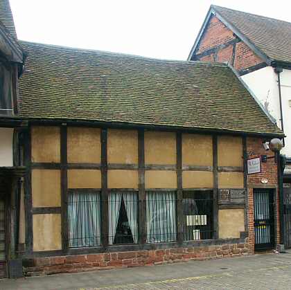
Helen F
Warrington |
240 of 514
Mon 8th Aug 2016 4:02pm
The Board Vaults was next door and to the right of the Recruiting Sargent, and was in the spot in the picture below. However this is from another part of Spon Street and I'm assuming that the original didn't survive the war. It was a bit smaller than the two on either side but I'm not sure it was this small. The buildings tended to get smaller towards Spon End.
|
| Streets and Roads - Spon Street | |

This is your first visit to my website today, thank you!
3,355,164Website & counter by Rob Orland © 2024
Load time: 47ms