|
TonyS
Coventry |
256 of 334
Mon 14th Sep 2015 11:53am
Cllr. Rachel Lancaster was on the radio this morning quoting £50,000 to repair it sufficiently for it to be placed back outside! (You couldn't make it up!)
Edit: I've just read that it costs £50,000 to maintain a WWII Spitfire for a whole year, how on earth can the restoration of a 'scrap-metal' horse cost the same? |
| Town Planning and Development - Friargate development | |
|
PhiliPamInCoventry
Holbrooks |
257 of 334
Sat 26th Sep 2015 9:25pm
Hi all 
|
| Town Planning and Development - Friargate development | |
|
Dreamtime
Perth Western Australia |
258 of 334
Sun 27th Sep 2015 4:51am
On 14th Sep 2015 8:51am, NormK said:
Sounds like a poor excuse to me Tony, I have worked with metals all my life and I know it's easily put right. If the truth is known 'Trigger' just doesn't fit into their plans whatever they are...
If it's corroded in the legs, that must be a lame excuse. ! (sorry carry on as if I wasn't here) |
| Town Planning and Development - Friargate development | |
|
Steve1966
Bedworth |
259 of 334
Thu 12th Nov 2015 8:02am
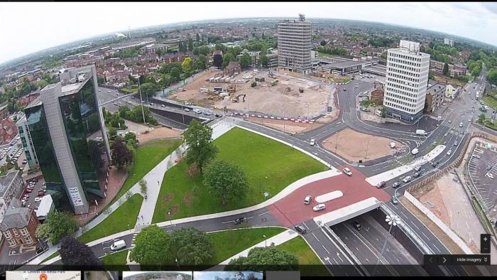
Morning all, I haven't been on for a while and have been trying to find a plan that shows the actual new road layout at Friargate. I was unfortunate enough to have to go to Central 6 a few weeks ago and ended up going past the church on Queens Road and then doing a U turn on Warwick road as I headed back to the city. I thought I had followed the road markings having left the ring road (clockwise). The 2nd time I went to Central 6 I worked it out. However, I have to take my daughter to the station tomorrow and cannot find a plan that shows the way in and out. It may be obvious but with my past experience with this 'creation' I'm not confident I'll find the way.
EDIT: I've just found a picture on google maps which explains it sufficiently. I'm glad I don't venture into this part of the city very often. It must be chaos at rush-hour. Progress...
Steve. |
| Town Planning and Development - Friargate development | |
|
TonyS
Coventry |
260 of 334
Thu 12th Nov 2015 9:42am
Hi Steve, you could also take a look at the plan in post 56 (page 4) of this thread. The arrows show the flow of traffic around the station |
| Town Planning and Development - Friargate development | |
|
Steve1966
Bedworth |
261 of 334
Thu 12th Nov 2015 11:00am
Thanks Tony. This is the picture I found. It seems to show 2 way traffic to and from the station now. Also I'm sure I read somewhere that you can't go back to the sliproad/roundabout the old way as it is buses only now?
|
| Town Planning and Development - Friargate development | |
|
flapdoodle
Coventry |
262 of 334
Thu 12th Nov 2015 11:15am
I use this junction at rush hour and it's fine. Never had a problem with it. Getting to the station is also better now.
Progress indeed. People have been complaining that Coventry is a concrete jungle for decades.
|
| Town Planning and Development - Friargate development | |
|
TonyS
Coventry |
263 of 334
Thu 12th Nov 2015 12:50pm
My son uses this junction daily and getting from Manor Road to Central Six island, at 5:30pm each day, takes him 30-40 minutes most days. |
| Town Planning and Development - Friargate development | |
|
NeilsYard
Coventry |
264 of 334
Fri 13th Nov 2015 10:08am
You cannot turn east bound on to the Ring Road if you are approaching North from Warwick Road at that junction. You either have to go West to the Croft Road junction and double-back or go down to New Union Street and get on the RR at Little Park Street. Bit daft. As Tony says - stay well clear at Rush Hour. Took my sister an hour to get out of Central Six a few weeks ago at that time! |
| Town Planning and Development - Friargate development | |
|
Midland Red
|
265 of 334
Tue 29th Dec 2015 4:37pm
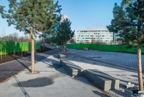
Contrasting views over Coventry Station (16 Oct 2014 / 23 Dec 2015), showing the progress in the demolition of Station Tower
  Work is underway in constructing the pedestrian route from the station towards the city centre
|
| Town Planning and Development - Friargate development | |
|
Midland Red
|
266 of 334
Thu 14th Jan 2016 12:42pm
Road closures and route changes as demolition of Coventry's Station Tower reaches final phase - Telegraph report |
| Town Planning and Development - Friargate development | |
|
TonyS
Coventry |
267 of 334
Sat 16th Jan 2016 10:10am
An interesting web-cam view of the development, as seen from the 10th floor of the adjacent tower, is available here. From the "image calendar", which provides a good history of progress, it appears that the image is updated every 20 minutes. |
| Town Planning and Development - Friargate development | |
|
Midland Red
|
268 of 334
Sat 26th Mar 2016 12:26pm
On 29th Dec 2015 4.37pm, Midland Red said:
Contrasting views over Coventry Station (16 Oct 2014 / 23 Dec 2015), showing the progress in the demolition of Station Tower
Another contrasting view from yesterday  

|
| Town Planning and Development - Friargate development | |
|
Midland Red
|
269 of 334
Sat 26th Mar 2016 2:27pm
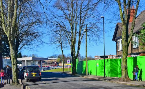
Park Road comparison - 23 Dec 2015 and 25 March 2016

|
| Town Planning and Development - Friargate development | |
|
Midland Red
|
270 of 334
Sat 26th Mar 2016 2:32pm
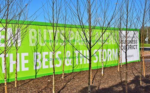
View from the railway station towards Greyfriars Green
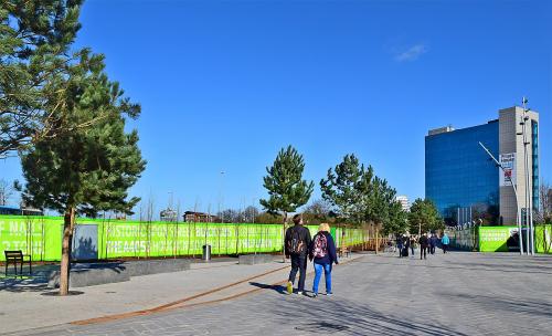 Even the Bees and Storm get a mention in the hoardings alongside the walk
|
| Town Planning and Development - Friargate development | |
This is your first visit to my website today, thank you!
4,033,050Website & counter by Rob Orland © 2024
Load time: 636ms